OCDM Geography Hierarchy
The lowest level of the Geography hierarchy (HGEO) is County (CNTY). CNTY has POPULATION attribute which can be used to track changes over time.
Tom determines that the POPULATION attribute value can be utilized to create an alternate (second) hierarchy denoting the Geographical Population Density.
The geography dimension finally has a flexible hierarchy Geography Hierarchy (HGEO) and Population Density Hierarchy (HGPOP) as follows:
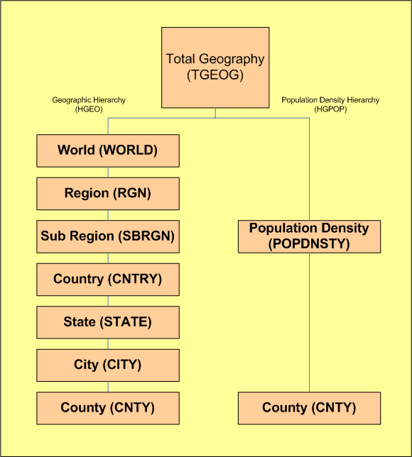
The lowest level of both Geography hierarchies (HGEO and HGPOP) is County (CNTY).