![]()
Previous
| Page 1 of 4 | Next
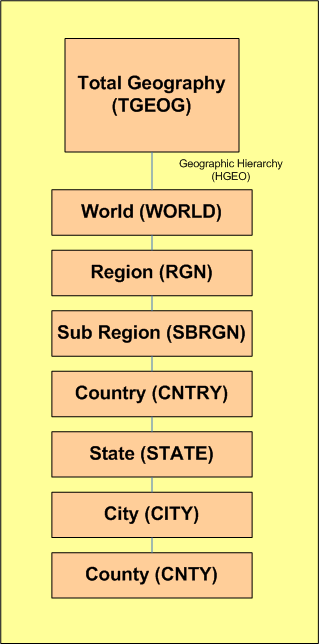
OCDM Geography Hierarchy
OCDM Flexible Hierarchy Data Model is a very powerful modeling construct which is capable of representing/capturing arbitrarily complex hierarchical structures.
For example, in OCDM the geography dimension has 1 hierarchy - Geography Hierarchy (HGEO) . HGEO has the following levels: CNTY, CITY, STATE, CNTRY, SBRGN, RGN, WORLD, as shown in the diagram below
Previous | Page 1 of 4 | Next